Receptores GNSS (GPS). Práctica 1. Receptores para Topografía y Geodesia

Los receptores GNSS son la interfaz de usuario a cualquier Sistema Global de Navegación por Satélite (GNSS) y su objetivo es procesar las Señales En el Espacio (SIS) transmitidas por los satélites. La mayoría de ellos se basan en soluciones de navegación del receptor que proporcionan posición, velocidad y tiempo. Las características principales de los receptores…

Subsidence in Lorca

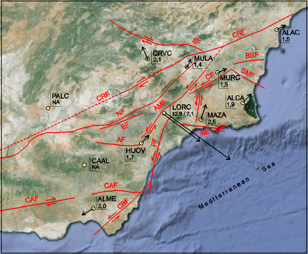
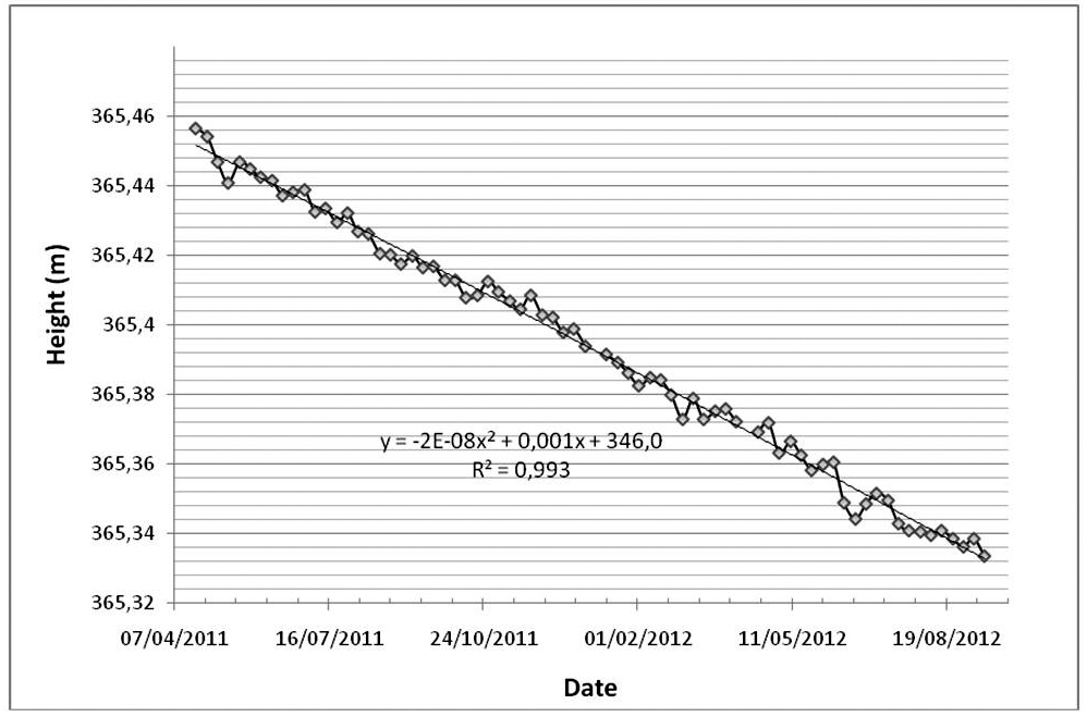
STUDY OF LAND SUBSIDENCE IN LORCA, MURCIA (SPAIN), BY #GNSS TECHNIQUES AND GRACE DATA

Land subsidence is a natural hazard that sometimes causes significant economic damage and great alarm. The causes of land subsidence are diverse and sometimes complex, and all lead to vertical deformations of the earth’s surface. These deformations can range from a few millimetres to several meters for periods ranging from minutes to years. This paper, in association…

El Hierro displacement

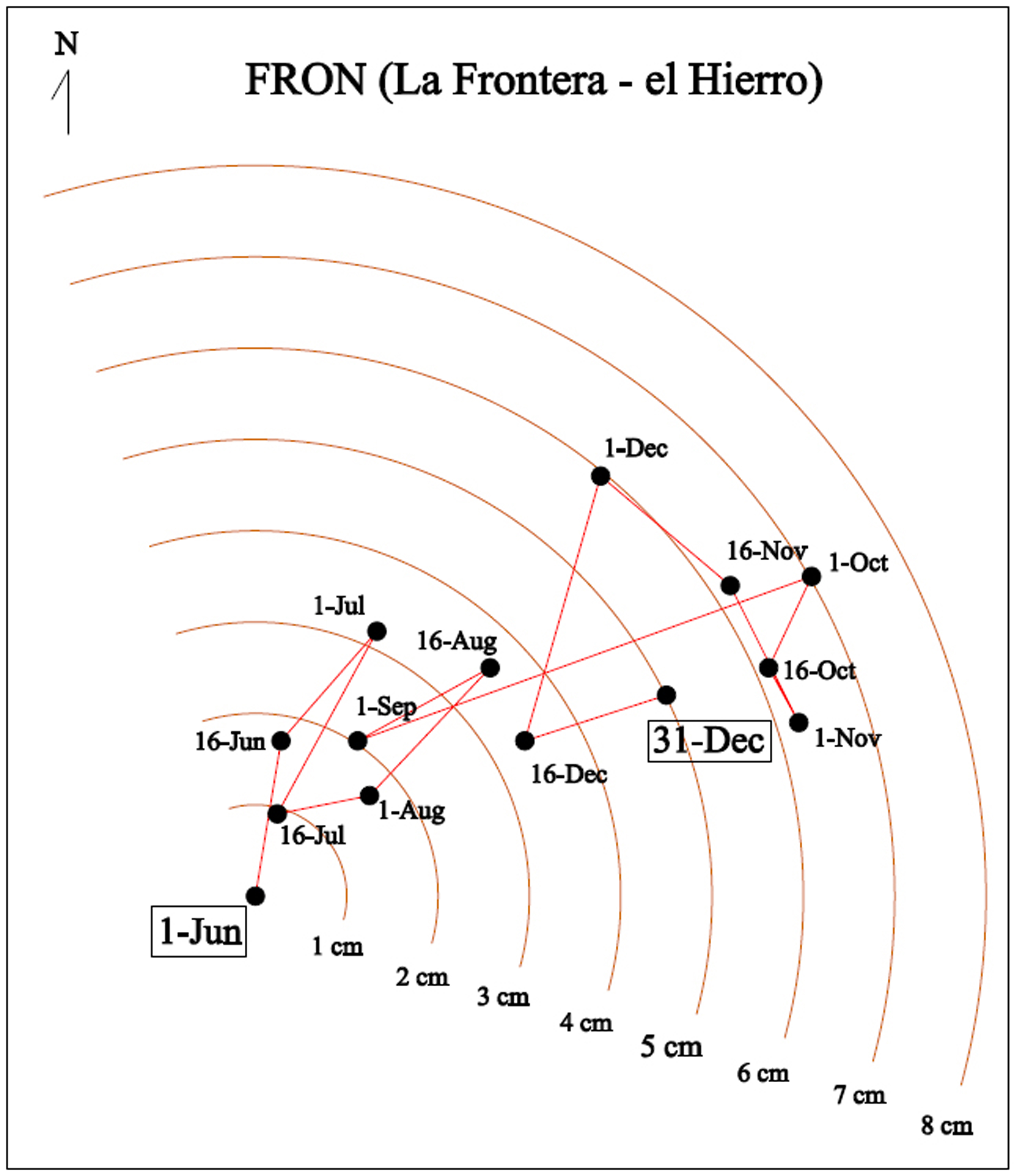
STUDY OF GROUND MOVEMENTS PRODUCED BY EL HIERRO SUBMARINE ERUPTION OF OCTOBER 2011 THROUGH #GNSS TECHNIQUES

Displacements and ground motions near volcanoes are one of the warning signs of volcanic eruptions. One of the most important tools to detect such movements is the technology provided by GNSS permanent stations network. This paper, in association with Albireo Topografia y Geomática, studies the use of GNSS techniques for the determination of the spatial and temporal displacements…

GNSS stations

STUDY OF PERMANENT PLATE DISPLACEMENT BY #GNSS TECHNIQUES, DUE TO THE EARTHQUAKE IN TURKEY ON OCTOBER 23, 2011

Sixty per cent of human deaths caused by natural disasters in the past decade were due to earthquakes. Earthquake monitoring has assumed great importance in recent scientific studies and one of the most recent additions to the numerous inter-disciplinary techniques employed for studying earthquakes are GNSS technologies. GNSS technologies and permanent station networks have created…