Actualmente desarrollo dos líneas de investigación / Currently devloping two lines of investigation:
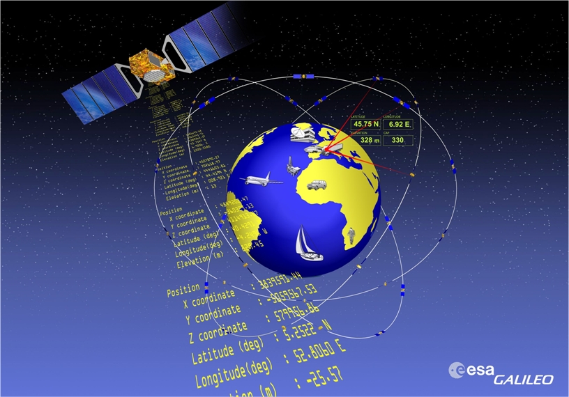
GNSS aplicado a estudios geodinámicos y de control de deformaciones /GNSS applied to studies of geodynamics and deformation monitoring
La Tierra es un planeta en continua transformación. Si retrocediéramos en el tiempo 1500 millones de años no reconoceríamos ningún rasgo actual en su superficie, ni montañas, ni cuencas oceánicas, ni posiciones relativas de los continentes. Por el contrario, si pudiéramos mirar la Luna con un telescopio que nos mostrara cómo era hace 1500 millones de años, observaríamos que su superficie, salvo algunos nuevos cráteres, no ha variado. Esto es debido a que la Tierra, al contrario que la Luna, aún no se ha enfriado y se mantiene geológicamente activa y en continuo movimiento. Con esta línea de investigación se están tratando de validar las técnicas GNSS como herramienta fundamental en estudios de geodinámica interna, orientando la investigación hacia la búsqueda de precursores en el ámbito de la sismología y vulcanología.
Planet Earth is in continuous transformation. If we could move back in time 1.5 billion years we would not recognize any current feature on its surface, no mountains, no ocean basins, and relative positions of the continents. By contrast, if we look at the Moon with a telescope to show us how was 1500 million years ago, we would observe its surface, except for some new craters, has not changed. This is because the Earth, Moon unlike, not yet cooled and geologically remains active and in continuous movement. With this line of investigation we are trying to validate GNSS techniques as a fundamental tool in internal geodynamic studies, directing research toward finding precursors in the field of seismology and volcanology.
Artículos publicados / Published papers:
DISPLACEMENT OF GNSS PERMANENT STATIONS DEPENDING ON THE DISTANCE TO THE EPICENTRE DUE TO JAPAN’S EARTHQUAKE ON 11 MARCH 2011
http://www.maneyonline.com/doi/abs/10.1179/1752270612Y.0000000025
ESTUDIO DE LOS DESPLAZAMIENTOS PERMANENTES DE PLACAS MEDIANTE TÉCNICAS GNSS, DEBIDOS AL TERREMOTO DE TURQUÍA DEL 23 DE OCTUBRE DE 2011
http://www.mappinginteractivo.es/images/revistas/REVISTA%20MAPPING%20162/Mapping162.html#/16/ (In collaboration with Albireo Topografía)
STUDY OF GROUND MOVEMENTS PRODUCED BY EL HIERRO SUBMARINE ERUPTION OF OCTOBER 2011 THROUGH GNSS TECHNIQUES TO FIND PRECURSORS TO ERUPTION
http://sylwan.ibles.org/syl/index.php/archive/part/158/6/3/?currentVol=158¤tissue=6 (In collaboration with Albireo Topografía)
BASIC STUDY OF DISPLACEMENTS OF ACTIVE FAULTS IN THE BETIC CORDILLERA USING GNSS TECHNOLOGIES
http://www.multidisciplinarywulfenia.org/archive.php/?volume=22&issue=2 (In collaboration with Albireo Topografía)
Ingeniería Topográfica / Survey Engineering

Desde las primeras civilizaciones ha permanecido la idea de territorio como el ámbito de una jurisdicción determinada, ya sea imperial (territorium romano), feudal (castillos), eclesiástica (parroquias), etc. El territorio se puede identificar con el marco físico sobre el que se desarrolla la actividad humana y donde se proyecta el poder político. Por esta razón, la delimitación del territorio y su representación cartográfica son fundamentales para el correcto desarrollo de múltiples actividades cotidianas.
Since the time of the first civilizations, the idea of territory as an area of a particular jurisdiction has existed; this jurisdiction could be imperial (roman territorium) feudal (castles), or ecclesiastical (parishes), etc. Hence, territory could be identified as the physical framework in which human activity takes place and where political power is carried out. For this reason, the definition of the territory and mapping are essential for the proper development of many everyday activities.
Artículos publicados / Published papers:
LAND SURVEYORS AS EXPERT WITNESSES IN REAL ESTATE LITIGATION MATTERS IN SPAIN
http://geodetski-vestnik.com/cms/images/57/1/gv57-1_villen.pdf (In collaboration with Albireo Topografía)
ESTUDIO Y ANÁLISIS DE LA REPRESENTACIÓN DE LA LÍNEA LÍMITE DE TÉRMINO MUNICIPAL SEGÚN DIVERSAS CARTOGRAFÍAS EN LA ALBUFERA DE VALENCIA
http://www.ub.edu/geocrit/sn/sn-448.htm
JURISDICTIONAL BOUNDARIES IN SPAIN, SURVEY AND MARKING OF BOUNDARIES IN TERUEL (SPAIN)
http://www.maneyonline.com/doi/abs/10.1179/1752270613Y.0000000071 (In collaboration with Albireo Topografía)
MEDIATION AS AN ALTERNATIVE TO LITIGATION IN SPAIN. APPLICATION TO PROPERTY BOUNDARY DISPUTES
http://www.kasmerajournal.com/show.php?v=43&i=1 (In collaboration with Albireo Topografía)
ATMOSPHERIC ATTENUATION AND SCINTILLATION EFFECTS ON THE RANGE OF EDM INSTRUMENTS
http://ascelibrary.org/doi/abs/10.1061/%28ASCE%29SU.1943-5428.0000142 (In collaboration with Albireo Topografía)
